Cornstalk Covered Bridge
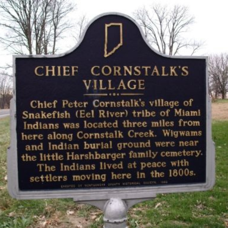
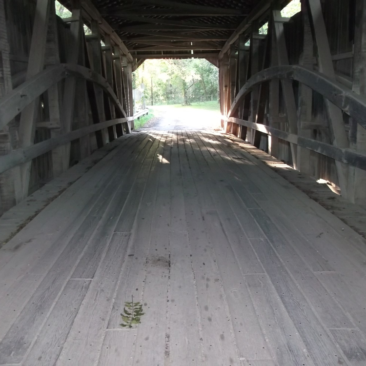
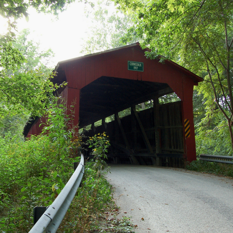
Constructed in 1917 by Joseph A. Britton, who also built Rolling Stone and Pine Bluff covered bridges, it is named for Cornstalk Creek which is spans, and it was rehabilitated in 1990. A single-span burr-arch/truss bridge, both it and the creek are named for Peter Cornstalk, Chief of the Eel River Tribe of Native Americans who once inhabited the area. The site known as Chief Cornstalk’s Village, “Snakefish,” is located roughly a mile northeast of the bridge. An Indiana Historical Marker recognizing Chief Cornstalk is located in Parkersburg, approximately two miles northwest of the bridge, in Montgomery County. The bridge itself is on West County Road 1350 North, east of U.S. 231, and there is room for one car to park near the east end.
Chief Peter Cornstalk, also known as Wneypuechsika Nenpemeshequa, Sachem Cornstalk, “Stout Man,” “Strong Warrior,” and “Young Peter Cornstalk” was born about 1746 at the Shawnee Nation, now Shawnee, Perry County, Ohio. A May 4, 1928, article in Greencastle’s The Daily Banner stated, in part, “Peter brought his immediate followers from Point Pleasant, West Virginia, soon after his uncle, Chief Cornstalk, senior, had been defeated by the whites, about 1790. Chief Peter and his dependents entered Ohio in the search for a new homeland, and entered Indiana, in turn, and had almost traversed it when they happened onto the then wild, beautiful region lying along the headwaters of Big Racoon Creek, about a mile and a half northwest of Roachdale. There they build their wigwams.
“Cornstalk and his people were well established when the first white pioneers entered northern Putnam County. So closely was he identified with the locality that the creek along which his encampment lay was given his name by most of the pioneers. Map-makers use the Shawnee warrior’s name in identifying the stream. Its waters were attractive to Native Americans. It passed near a Miami town not far from the present location of Thorntown, then flashed by Cornstalk’s settlement, and went on, past Shawnee and Miami camping places, down to Portland Mills, where there were Native Americans, emptying into the Wabash River near Mecca.
“Not only was the headwater stream named Cornstalk, but the pioneer church built nearby was named after the chief. The foundation stones are all that remain of the ancient place of worship. In the same area is the old burying ground of the pioneers, with stone markers that carry one back into early decades of the last century. When Peter Cornstalk buried his dead on the high bluff that overlooks the stream near his home, he may have had a vision of their spirits finding pleasure in being so near their beloved creek. Over the decades, the flooded current lapped away at the feet of the bluff and some of the graves, at least, were washed away. Others may be under the soil now traversed by the road which was built in later years.
“Chief Peter Cornstalk was the best-known Native American who frequented Putnam County. His band had temporary camping places on Big Walnut Creek. They mingled with the white pioneers freely.”
Other documentation of Chief Cornstalk interacting with the early settlers of Putnam County appears in an article in the Crawfordsville Review on August 26, 1899. It noted that Chief Cornstalk began bringing his corn to be ground at David Swank’s mill at Swanksville, which was located along Raccoon Creek, about a mile southwest of Raccoon. As part of the Indian Removal Act of 1830, Chief Cornstalk and his band of Shawnee Indians were removed to Kansas, probably about 1832. It is believed he died there about 1833.


Access
-
DIRECTIONS: STARTING FROM THE PUTNAM COUNTY COURTHOUSE, HEAD NORTH ONTO US-231. IMMEDIATELY NORTH OF US-236, YOU WILL CROSS BIG RACCOON CREEK, THEN TURN RIGHT ONTO WEST COUNTY ROAD 1350 NORTH. AT THE “T” IN THE ROAD, TURN RIGHT ONTO NORTH COUNTY ROAD 275 WEST, WHICH WILL TURN INTO WEST COUNTY ROAD 1340 NORTH, FOLLOW THIS UNTIL YOU COME TO THE COVERED BRIDGE.
-
HOURS: 24/7
-
FREE PARKING – FREE ADMISSION
DIMENSIONS
-
TOTAL LENGTH: 84′
-
LARGEST SPAN: 80′
-
WIDTH: 15’7″
-
HEIGHT: 13’8″
Contact/Links
-
PUTNAM PARKS & PATHWAYS
765.653.8743
[email protected]
12 WEST WASHINGTON STREET, GREENCASTLE, IN, 46135